|
 One theory of earth energies suggests that there is a mathematical precision
to how electromagnetic and/or magnetic energies flow in an orderly pattern
across the face of the earth. Places on earth which do not behave within
our expected time-space continuum, such as the Bermuda Triangle, have even
been mapped. One theory of earth energies suggests that there is a mathematical precision
to how electromagnetic and/or magnetic energies flow in an orderly pattern
across the face of the earth. Places on earth which do not behave within
our expected time-space continuum, such as the Bermuda Triangle, have even
been mapped.
William Becker and Bethe Hegens, a husband and wife team are credited in
the 1970’s with final development in of the model called the ‘UVG
120 Earth Star’, which is a geometrically based model of earth energies.
It suggests that the earth’s energies flow along predetermined and
predictable patterns across the planet, and that the flow is based on mathematical
principles.
Becker and Hegens were also inspired by the work of Ivan P. Sanderson, a
researcher who worked on the puzzle of an earth grid throughout the 60s and
into the 70s. Sanderson was mystified by how ancient mapmakers were able
to plan out a full, global map. How did they break the Earth's surface up
into measurable units? And furthermore, was there anything that was physically
observable and measurable in the vastness of Earth's oceans, so that these
mapmakers would actually know where they were in the middle of the sea?
Sanderson tackled huge volumes of data, mostly from reports declared by hundreds
of pilots and mariners, and systematically organized them. He documented
finding old maps which showed the coastline of Antartica as being green and
bountiful. His results proved beyond a shadow of a doubt that some very interesting
anomalies were visible in certain areas of the Earth's oceans. These anomalies
are all very familiar to us, as being those commonly reported in the Bermuda
Triangle.
Using statistical analysis to crunch all the data together, concerning all
the different places where these events occurred on the globe, Sanderson
was able to derive twelve common points on the Earth. Amazingly, these twelve
points were all equally and harmonically spaced from each other! The effects
of these "vile vortices," as he called them, included not only
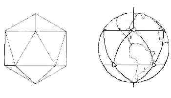
disappearances but apparently time-warping events as well. Below is am image
of Sanderson's original twelve symmetrically spaced vortices which graph
out the earth in multiple icosahedrons
Many of these were recorded in books such as Charles Berlitz's The Bermuda
Triangle. But, Sanderson found evidence of these time-space disturbances
in the other vortices as well, not just by Bermuda. For example, one of Sanderson's
vortices was located near Hawaii. He found a report of a pilot, flying with
passengers very near this zone, who suddenly lost all of his instruments
as well as radio communications. This is called a "dead zone," or "flying
blind," with no ability to radio for help or to determine altitude,
position, et cetera, except by "eyeballing" it. The pilot continued
to fly for roughly 350 miles in this "dead zone," without being
able to connect with anyone on the radio; anywhere from 30 minutes to an
hour, depending on his speed. Finally, the bizarre experience came to an
end, and he was very relieved to be able to get in touch with the tower yet
again.
Becker and Hagens' were also drawn to the work of Chris Bird, who wrote his
article on the "Planetary Grid" in the New Age Journal of May 1975.
They were so overwhelmed with this information that they eventually set up
a meeting with him to discuss the work. Soon after this, they "completed" the
Grid, making it compatible with all the Platonic Solids, by inserting a creation
from Buckminster Fuller's work. See what this meeting inspired:
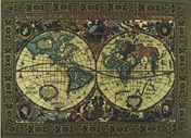
If you look at it just right, you will see the pyramids parading across the
entire map. Notice that there is a major vortex just off the coast of South
Florida, the so called ‘Bermuda Triangle’. Recent events add
confirmation to that one. And, it is one of the fabled locations of mythic
Atlantis. Alexandria, San Diego, Hawaii, and Tahiti are all in significant
areas. Africa is such a gigantic and central continent that she has two major
energy places; in the Northwest as well as the Southeast! Remember that Ivan
Sanderson originally described them as ‘vile vortexes’, and look
at the map- it’s revealing.
There are other earth energies, also. Energetic lines run both above and
below the surface of Gaia. One example of above ground Ley lines would be
the synchronistic alignments of ancient sites, well developed and documented
in Great Britain and France. Other cultural temple icons such an Ankor Wat
in Cambodia are also considered to be in energetic ‘hot’ spots.
Many ancient sites or holy places fall into alignment along straight lines
along the earth.
The man who first documented this vision in 1921 was a British businessman
named Alfred Watkins. Watkins described his image as a ‘fairy chain
stretched from mountain peak to mountain peak as far as the eye could reach
and paid out until it reached the high places of the earth.’ He surmised
that the straight tracks, or ley lines were the remnants of prehistoric trading
routes and part of his vision was seeing night lanterns glowing to show the
way for travelers. Watkins went on to associate ley lines with the Greek
god Hermes (a.k.a Mercury, and the Norse god Woden) who was the god of communication
and of boundaries, the winged messenger, and the guide to travellers on unknown
paths. Watkins identified Hermes-Mercury with the chief god of the Druids.
Wouldn’t it be wonderful to travel to all of the exotic locations to
research if these places really do indeed hold special earth energies? Sounds
like a good project; I suspect those Mayan gods want to be fed by our homage.
And, somebody needs to research rainbows, crop circles and mystical waterfalls.
*Reprint credits
1.) Anti-Gravity and the World Grid, David Hatcher (Adventures Unlimited
Press, Box 74, Kempton, Illinois 60946: 1987, 1995.)
2.) The Planetary Grid system was inspired by an original article by Christopher
Bird, ‘Planetary Grid’ Published by New Age Jouranal #5, May
1975, pp. 36-41. The hexakis icosahedron grid, coordinate calculations, and
point classification system are the original research of Bethe Hagens and
William S. Becker. These materials are distributed with permission of the
authors by Conservative Technology Intl. in cooperation with Governors State
University, Division of Intercultural Studies, University Park, Illinois
60466 312/534-5000 x2455.
© Maya White/White Star Astrology/ 2009 |
